This is the story of Jamila's first cruise of 2024. It was a somewhat late cruise by normal standards, in part due to health issues, but much anticipated over the preceding winter months. The favoured plan was to head to the Isle of Man in the hope of seeing some of the TT, but there was a strong northwesterly blowing - thus an unpleasant head wind. This forced a change plan to the north coast of Wales, namely Anglesey and the Menai Straits.
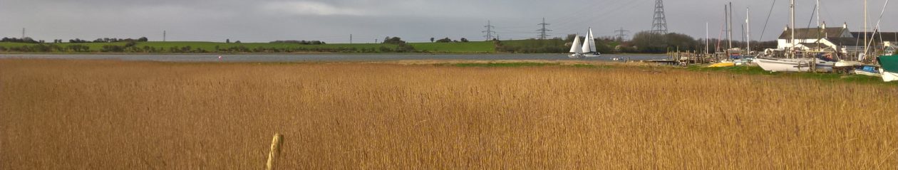
The cruise started with Jamila anchored in the River Wyre off Wardley’s Creek. Supplies were transported from the shore to the ship in two stages. At first, a batch was carried on foot over the sand from the nearby caravan park access point. Later, after the tide had come in, the dinghy, outboard, and remaining heavy stores, including diesel and water, were brought over. The skipper spent the first night moored on the river, allowing time to thoroughly clean the hull before the morning tide arrived. This mainly involved removing the green algae accumulated around the waterline over winter.At around 9 am and still on the river opposite WMYC, the tide is coming in, and Jamila, with a lot of keel scraping, has just spun around to face the incoming tidal set.My passage plan – thanks to Andy Sargent. The numeric table above gives details of each leg of the passage.
The destination is Rhyll in North Wales.
The sails were made ready from the start but were only hoisted once at the Fairway buoy. We’re well underway at this point. We’ve completed the initial legs down the River Wyre and then along the Deeps towards the Lune Buoy. The photograph was taken at the start of the longest passage down to the Welsh seaside town of Rhyl. A sharp-eyed reader may have spotted a well-known Fylde coast landmark in the distance.
During the cruise, I couldn’t help but admire my new wooden instrument panel enclosure. The previous one had rotted away, which put the important dials (temperature and oil) at risk of falling into my stern locker. Vic Mathews, a stalwart club member, came to my rescue and built the new enclosure only weeks before, as you can see here. It is made of sturdy iroko hardwood, and its smearing of sand makes it look like it has been there forever.Currently anchored off Rhyl, waiting for the tide to come up even further.
A chart plotter view of Rhyl. Was anchored roughly to the left of the outer marker.
A similar view to the one above but on an ordinary iPhone showing the boat’s position.
There are two pontoons in Rhyl: an outer and an inner. The outer is an island pontoon requiring a dinghy to row ashore, whereas the inner pontoon has steps leading to the quayside.
The following day at low tide, but now plugged into the electric grid.
Poor weather came the following day. No plans to move anywhere!
Nevertheless, with the stove burning, Jamila’s living space was kept warm and dry, just like home – if not better.
I strolled around Rhyl in search of something visually appealing. Eventually, I came across a Wayfarer dinghy that served as a delightful attraction at a mini-golf course. It was particularly fascinating from the perspective of an old sailor.
On the third day, I sailed towards Menai Bridge facing F6 headwinds throughout the journey, with the engine running the whole time. I used the engine because, unfortunately, a heavily reefed Mirage 2700 cannot sail effectively close-hauled in overly windy and choppy conditions. From right to left, you can see Great Orme Head and Little Orme in the photograph, while Llandudno is barely visible in the gap.
I gave the Great Orme Head a wider berth than initially planned. The GPS rolling road is fantastic for navigation. It displays an imaginary road to your desired destination and plots your current position in conjunction. For example, it indicates when you have lost track (pulled off course) by either tide and/or leeway.
I arrived at Menai quite late in the day and grabbed a buoy near a summer house peeking through the trees.
I moored overnight in the Small Craft Moorings area as shown.
The next morning, I had to quickly head towards the Menai Bridge. Sadly, I didn’t have time to explore the area around the mooring location and make sure to negotiate the Swellies when the tide was slack.
Waiting near the Menai Bridge. Menai and its resident large training ship.
Almost slack water now. The bridge is beckoning Jamila to come through.
It is now time to go. Jamila’s mast is fast approaching the bridge. Will it go under?
On the other side now and offically in the Swellies, although to be fair still some way off the first of the dangerous rocks.
Approaching the Britannia Bridge. All potential dangers are now behind us. In fact it is easy when there is no tide rushing you through around the rocks.
After the Swellies, you briefly find yourself in a setting resembling the Norfolk Broads. You can see a magnificent country house called “Plas Newydd.” and regardless of your feelings toward the privileged classes of old, it’s undeniable that wonderful houses and gardens were left for everyone to enjoy.The gardens and paths of ‘Plas Newydd’ come down to the water.
A church and steeple are visible through a gap in the trees, with farmers cutting hay in the surrounding green fields.
But very soon, the straits widen and become more estuary-like, and Port Dinorwic shows up on the left.
There’s a bay just beyond ‘Port Dinorwic’ on the left with a beach and three, usually available, red buoys. This is where I rested for the fourth night. Throughout the evening, a path through the trees brought people down it so they could enjoy the beach and special atmosphere..This included fishermen, swimmers, and courting couples when I was briefly there.
This is a 180-degree panorama photograph of the above-mentioned bay.
With ship’s stores running low on certain items, I took charge and ventured into Port Dinorwic to resolve the situation. I noticed that my old outboard motor wasn’t circulating water properly. Once back at the mother ship, I solved the problem by removing some debris from the water cooling using a large syringe I had left over from earlier in the year.
At this point, I decided not to circumnavigate Anglesey as planned. Strong winds were still coming from the northwest, potentially making the upcoming journey very challenging and tiring. My wife and daughter called me and said they would like to visit ‘Plas Newydd’ country house I had just recently sailed past, so instead, I planned to sail over and spend the night at Abermenai Point to at least look at the coastal area I would have passed through had my plans not changed. The following day I would return to Port Dinorwic to do the family house visit.
The next day I sailed from the bay to my next destination, which was the shortest so far. Using the depth sounder, I located the best spot to anchor the boat, taking into consideration a tall dune that would provide shelter from the wind. This photo was taken from the top of the dune at Abermenai Point, and it was where I tried to explain why I wasn’t sharing pictures of fast TT motorcycles with a friend on social media.
Exploring Abermenai Point.
On a sandbank uncovered at low tide – as seen in the previous photograph.
A typical lunch on board, simple but satisfying.
Pilotage notes for visiting Abermenai Point (1/2)
Pilotage notes for visiting Abermenai Point. (2/2)
After spending the night anchored at Abermenai Point, the next destination was a return to Port Dinorwic but this time in the Marina. The marina is unique in that it is situated in a natural long narrow gorge that exits from the Strais. It was originally built for the slate quarry trade over a hundred years ago and features a potentially operational dry dock at the far end.
Meeting my wife and daughter at Port Dinorwic marina. There is a lock between the sea and the inner harbour where, as seen in the photo, both gates can be opened simultaneously at HW.Rafted onto an ex-sailing trawler converted to a yacht. Hello family!
The wife and daughter have departed; I am now relaxing in the evening sunshine.
The country house visit was on the 8th of June. A return through the Swellies and reach the north end of the Menai Strait on the 9th. And the final passage to Fleetwood on the 10th. The photograph shows the weather forecast to be faced.
I left Port Dinorwic with an hour to spare and traversed the Swellies. Now, on passage up the northern straits towards Puffin Island. The photograph shows a sailing ship going full speed ahead under the engine – the reason being it was plugging the recently turned tide.When near Puffin island and after seeing the recently forecasted shift in wind for the next day from westerly to the north noth westerly, I decided to position myself as far to west of Wales as possible while the winds were favourable. Thus I opted to go to Moelfre where I would get shelter from the prevailing strong westerly wind over night.
Made it! After the downwind leg to Puffin Island, conditions were such that I could sail towards Moelfre close-hauled under full genoa and reefed main and not using the engine! One long tack and a few short tacks were quite enough. During the sail I experienced all conditions from the sun, blue sky, drizzle and clouds. Once arrived, it completely greyed over and started to rain.
Returning to Fleetwood took fourteen hours after spending the night at Moelfre. The journey can be split into four parts. For the first part, I sailed close-hauled under full genoa and reefed main, taking advantage of the favourable tide for about three hours. As we entered Liverpool Bay, the engine was needed to maintain sufficient speed to stay on track. This lasted for about four hours. Eventually, as forecasted, the wind shifted back to the west and strengthened to F5/6. This allowed us to pick up speed to over 5 knots, making up for lost time. This phase lasted eight hours which was great. Most of the time, it was classic blue sky and blue sea sailing. As Blackpool tower came on the port side, the wind increased to F6, and the tide changed. I had to reef the genoa, and due to plugging the tide, Jamila’s speed slowed to 4 to 5 knots. When Jamia reached Fleetwood, the tide was still ebbing hard, and Jamila got knocked about by breaking waves coming into the channel. To make matters particularly difficult, the wind was from directly behind, causing several uncontrolled jibes while fighting with the rudder to keep between the buoys. The engine was required to add an extra knot of speed to escape a bad patch of breaking waves. Eventually, Jamila was safely anchored in the very shallow river Wyre opposite the golf course. A part of the ‘last night’ was thus spent immobile at anchor, and between two and three o’clock the following morning (HW), Jamila was moved up the river under engine and put on her Jetty at Wardleys Creek. The second part of the ‘last night’ was then spent in a deep dream and a warm sleeping bag. The voyage had come to an end.
That’s all, folks. And a shout out to John Gorse for all his hard work sluicing out the slipway.