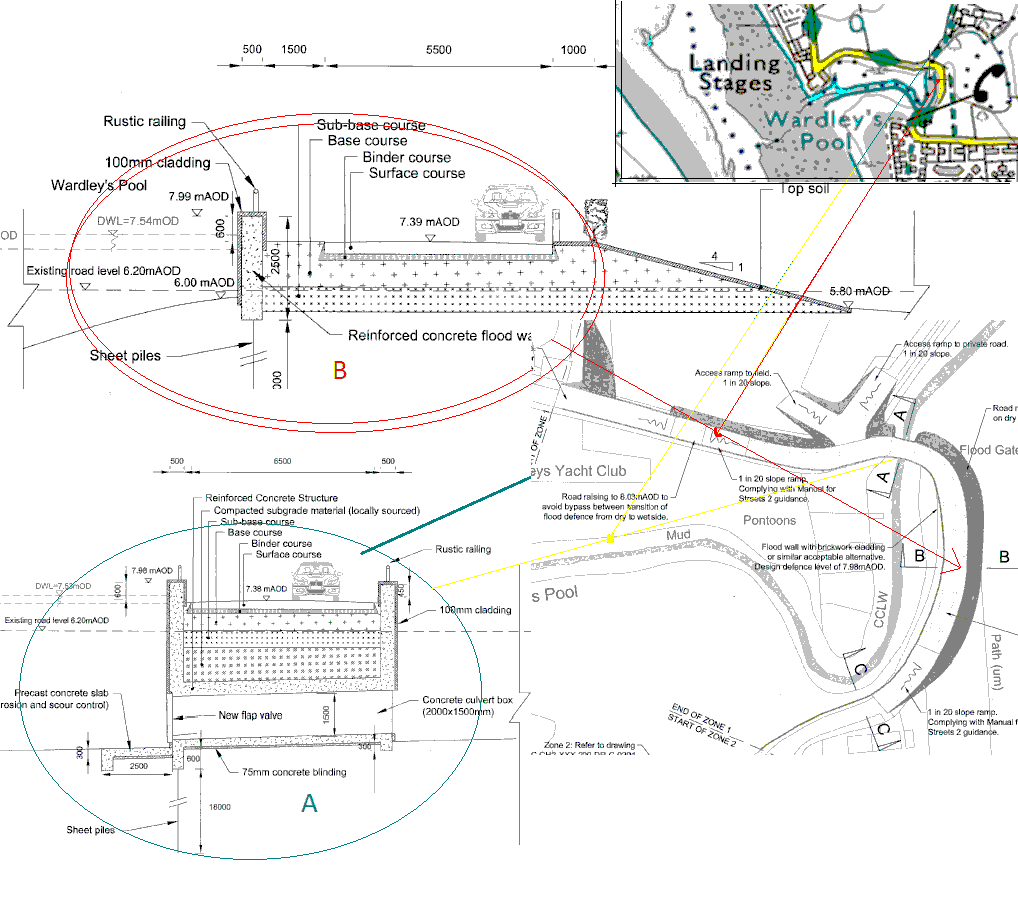
The Environment Agency has unveiled plans for extensive works adjacent to the club, designed to reduce the risk of flooding in the area. In a nutshell, this involves raising the level of Kiln Lane by over a metre between the phone box and the club gate, and continuing with a wall between Shore Road and the marsh, southwards in the direction of Shard Bridge.
Possible negative effects are:-
- Possible effect on parking on Kiln Lane
- Reduced access to club land on the south side of the creek
- Disruption during construction
- Wasted effort when the proposed Wyre Barrage claims to mitigate upstream flood risk
- Unknown whether this affects the flow of water in the creek
- Club is on the ‘wet’ side of the wall, therefore no change to risk of flooding at the club
Apparently the plans have generated some opposition among local residents, and a meeting has been called, at Hambleton Village Hall on Thursday 29th November at 7pm.